
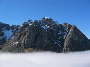
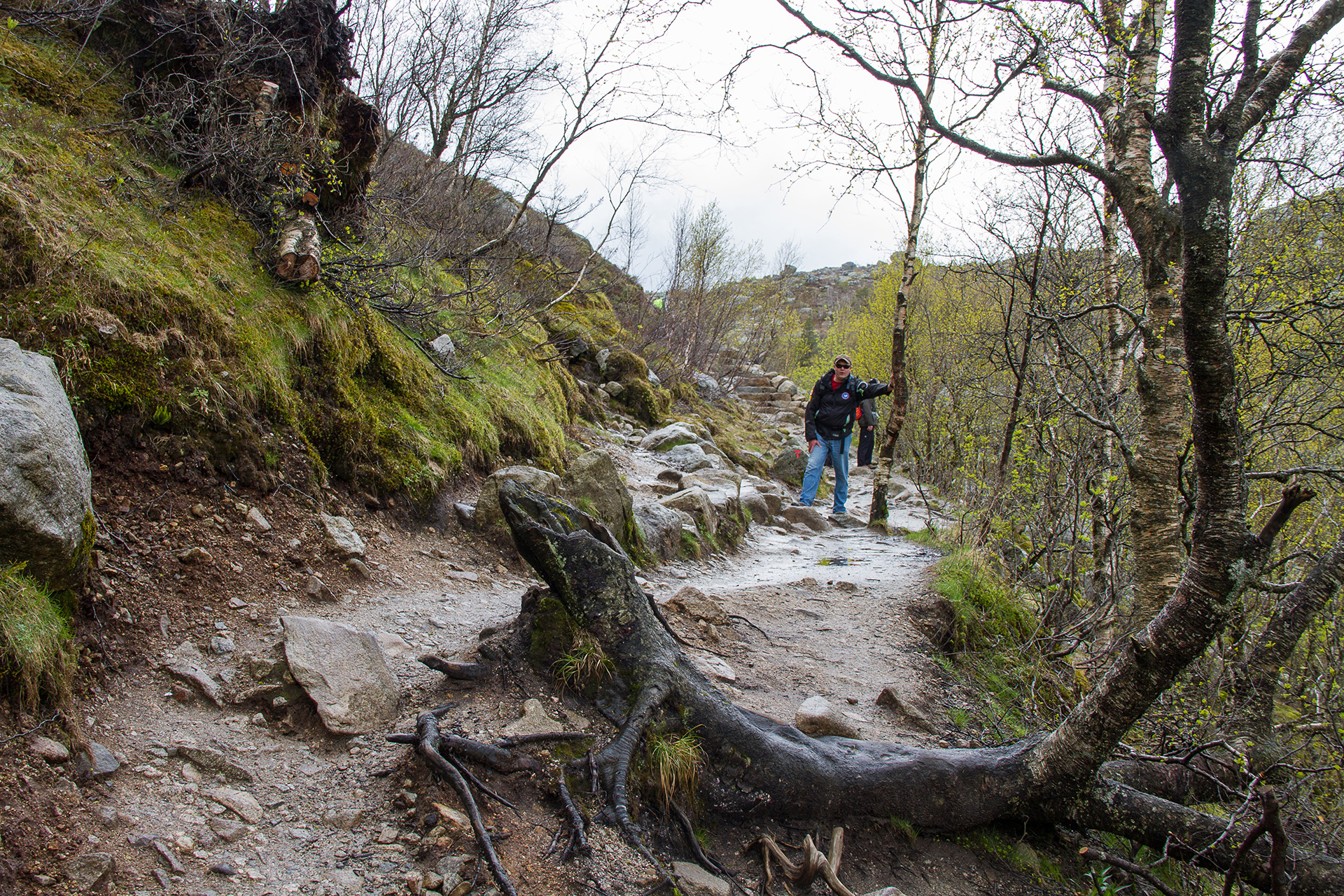
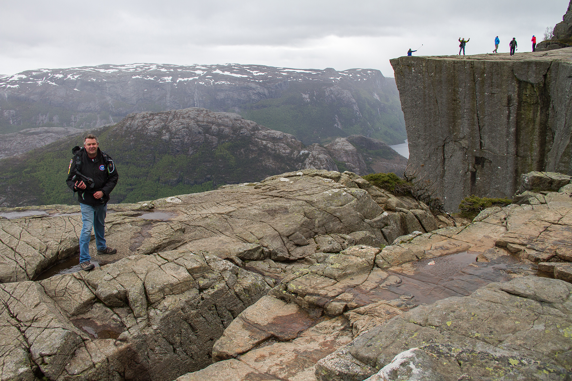
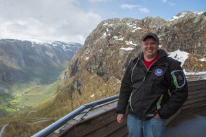
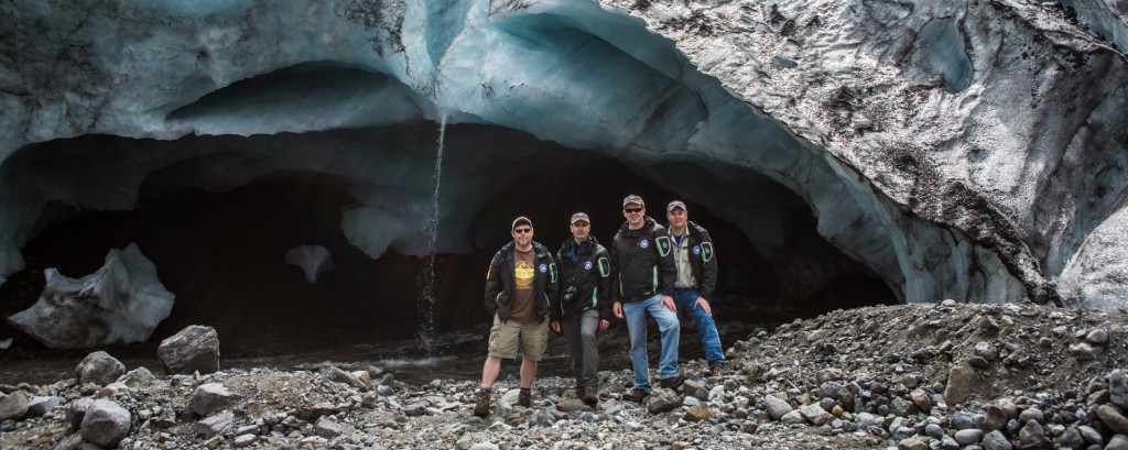
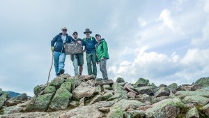
Outdoor adventures come in various categories. Some people travel to large alpine ski resorts and stay in luxurious condominiums and enjoy fine dining each evening. Some people travel to all-inclusive resorts in the Caribbean and lie on the beach sipping mojitos and for excitement go snorkeling over coral reefs. We on the other hand like to travel to places more off the beaten path. Ryan and I prefer to travel to locations such as Iceland, where we climbed on recently active volcanoes or strolled around pools of boiling mud along the Mid-Atlantic Rift. When we were in Norway, we climbed steep trails to peer over the edge of cliffs more than 600 m above the fjords. We also climbed over large glaciers in Norway and enjoyed a sip from the ice cold meltwater draining from under the 10,000 year old ice. Some people may find our choice of locations strange. Many people do not want to travel to places with poor weather, or spend hours driving between hiking locations, and some may even be put off by the lack of civilization in the areas we have travelled (restaurants and accommodations are usually scarce where we go). But this is what the Trekkit Team thrives on.
Different outdoor adventures require different vehicles to meet your needs. In some cases you have to compromise while in certain circumstances only one vehicle may do the job. I will discuss why we selected the vehicles we have so far on our Trekkit adventures, list the pros and cons, and discuss vehicle choices for our upcoming 2016 trip to the Scottish Highlands, and future Trekkit adventures.
Expedition Iceland 2014
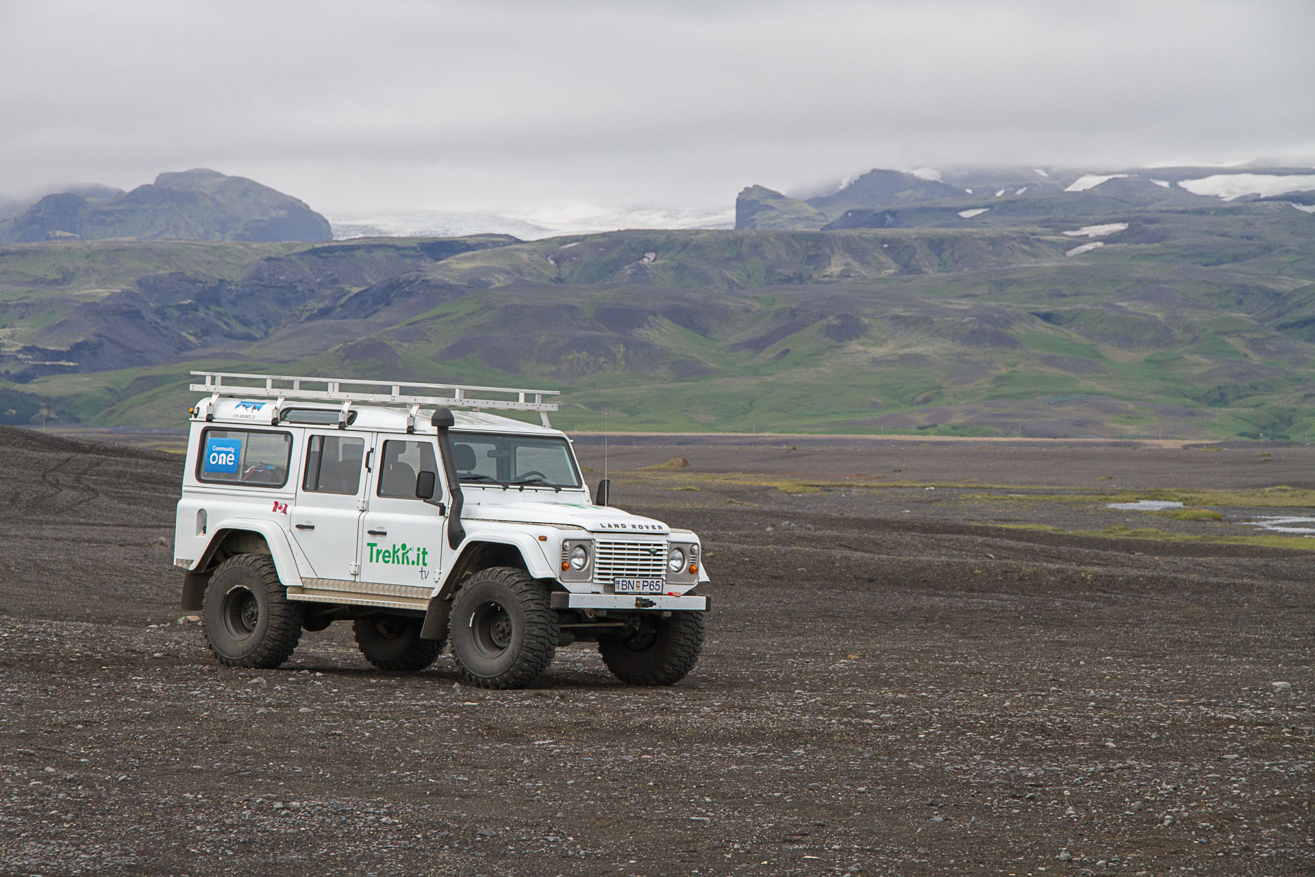
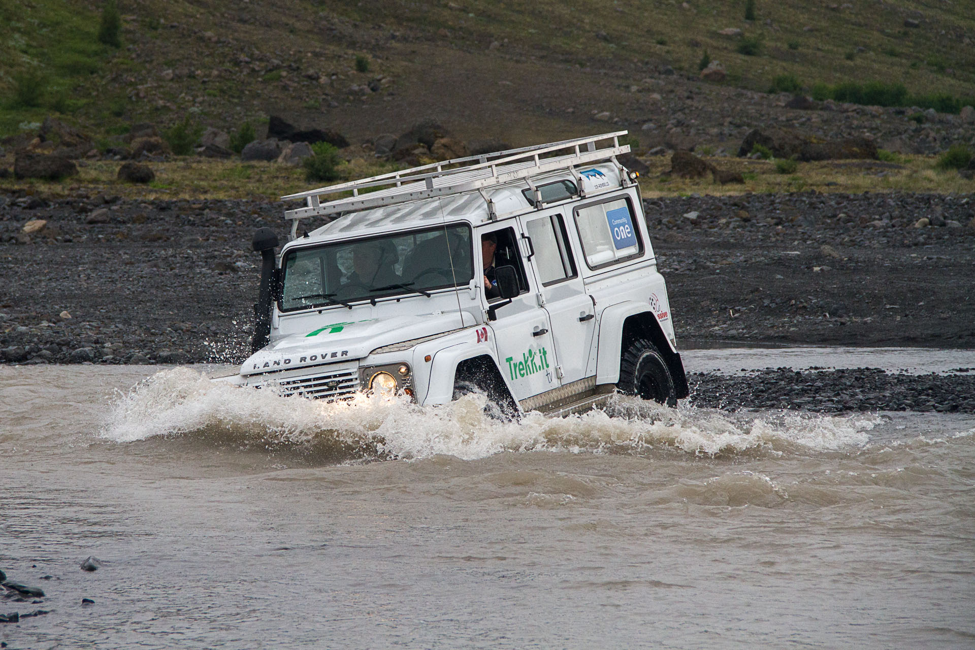
 For Trekkit’s adventure to Iceland, we rented a Land Rover Defender. This was a hard core off-road vehicle. It was diesel powered with a manual shift transmission. It also had over-sized off-road tires, high ground clearance, and a snorkel air intake. The Land Rover Defender was very rugged and definitely an old-school machine considering it had been in production with minimal changes since 1948 (20 years before I was born). The Land Rover was selected for our adventure to Iceland because the plan was to drive the interior Highland Roads. To be clear, these roads are not paved, they are little more than a path, water crossings are plentiful and there are no bridges. This is where the 37 inch tires, 12+ inch ground clearance, and raised snorkel air intake were important. Our wives initially thought we got the Land Rover only because it was cool looking. The Land Rover Defender was amazing to drive on the interior roads and was essential during the water crossings, where water sometimes was above the hood. However, I must admit that the Land Rover had some shortcomings. When traveling on the paved roads, it wondered around as if the steering wheel might not be connected at all. The clutch was terrible, the brakes were frightful, and the engine barely had enough power to climb some of the hills. With the four of us on board, plus our luggage, we would frequently crest hills at very slow speeds after having to gear down to 4th, 3rd, 2nd, and sometimes even to 1st gear just so it wouldn’t stall. Comfort and ergonomics in the interior was minimal and I should also add that it consumed fuel like fish drink water. We never calculated the fuel mileage – it would have been too scary. Despite the shortcomings, it was a fantastic vehicle to drive in Iceland.
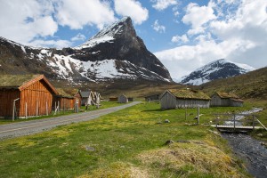
Western Fjords of Norway 2015
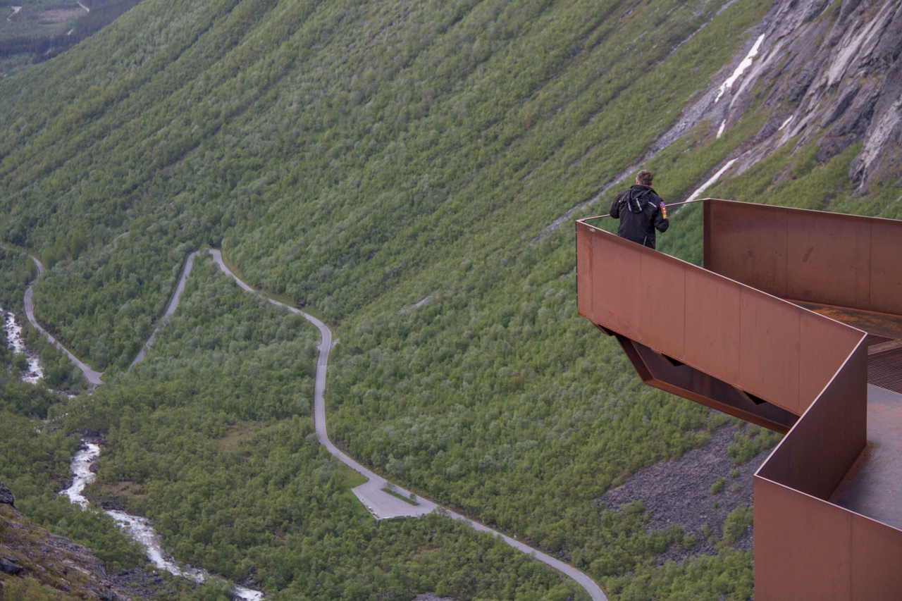
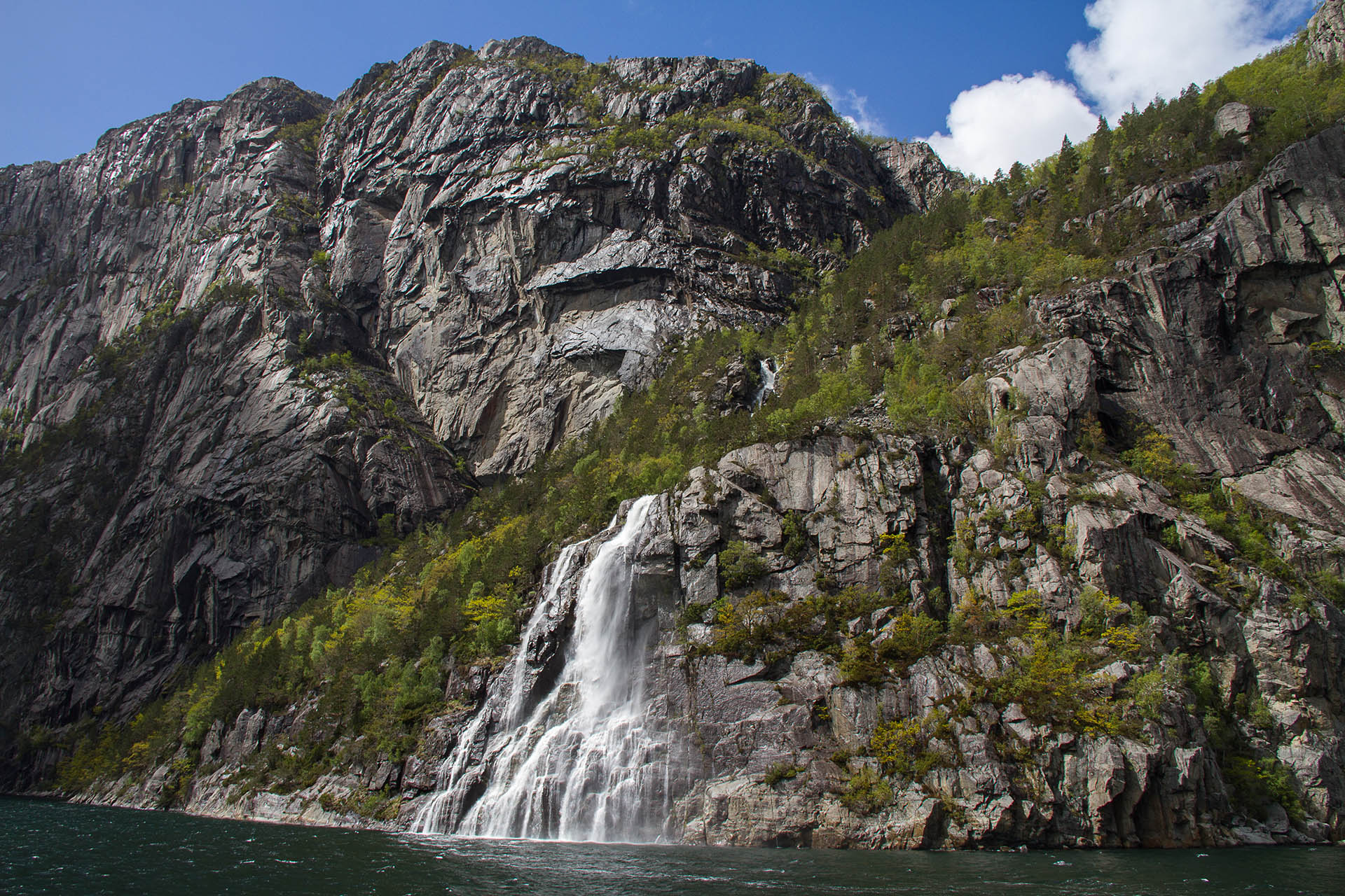
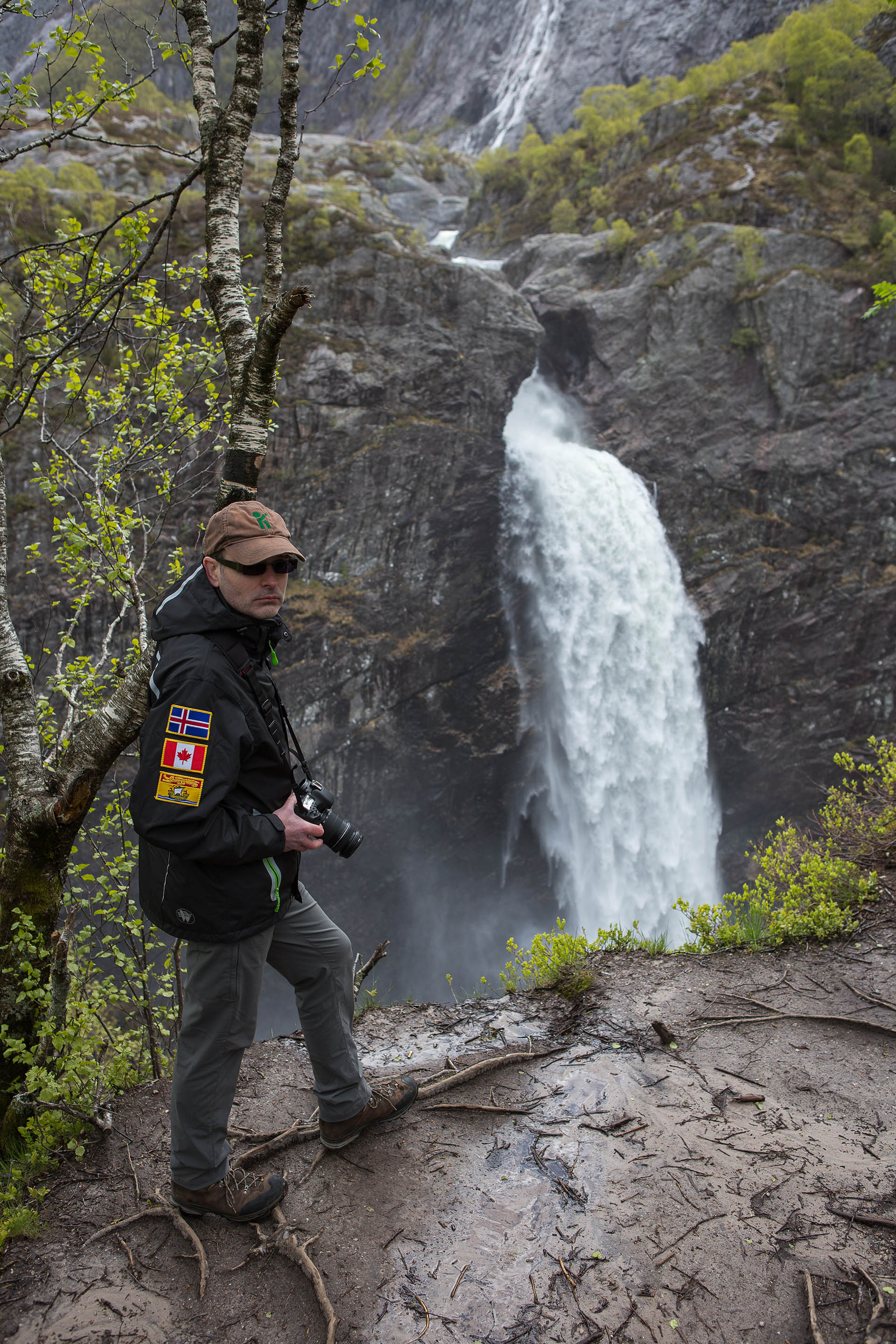
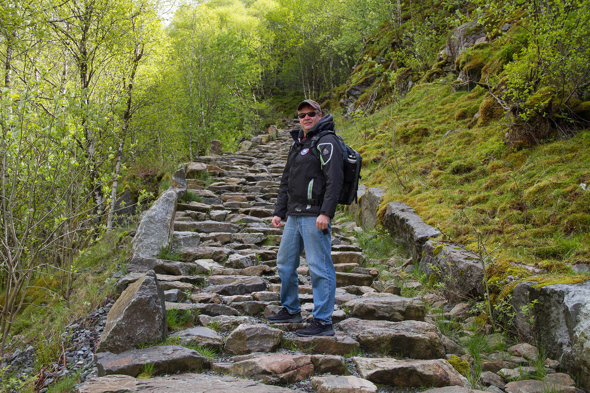
 The Trekkit adventure to Norway was quite different than Iceland. We drove through the Western Fjords and visited waterfalls, glaciers, and gorges along the way but stayed mainly on the pavement. The infrastructure in Norway was outstanding. The condition of the roads was better than anything I have ever seen. The roads were very smooth and we didn’t see a single pot hole during the entire trip, and we only traveled on the back roads. However, as is common in many European countries, the roads are relatively narrow. In fact, at times you might forget that you are actually on a two lane road. The road was often too narrow for two cars to pass. Wider pull offs are constructed every few hundred meters to allow you to pull over when you actually meet another car. Therefore, we needed a small car and we didn’t need anything to travel off-road with.
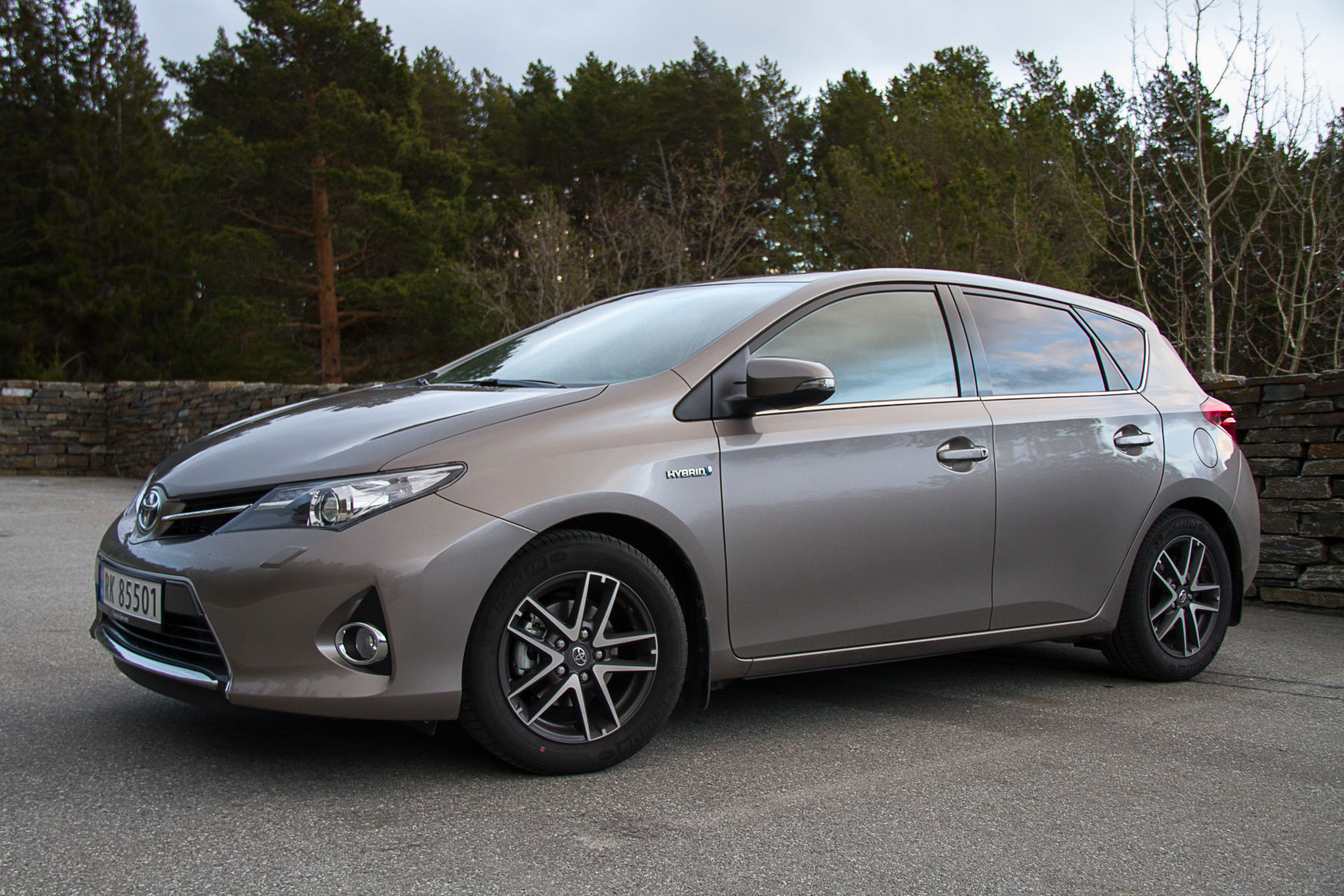
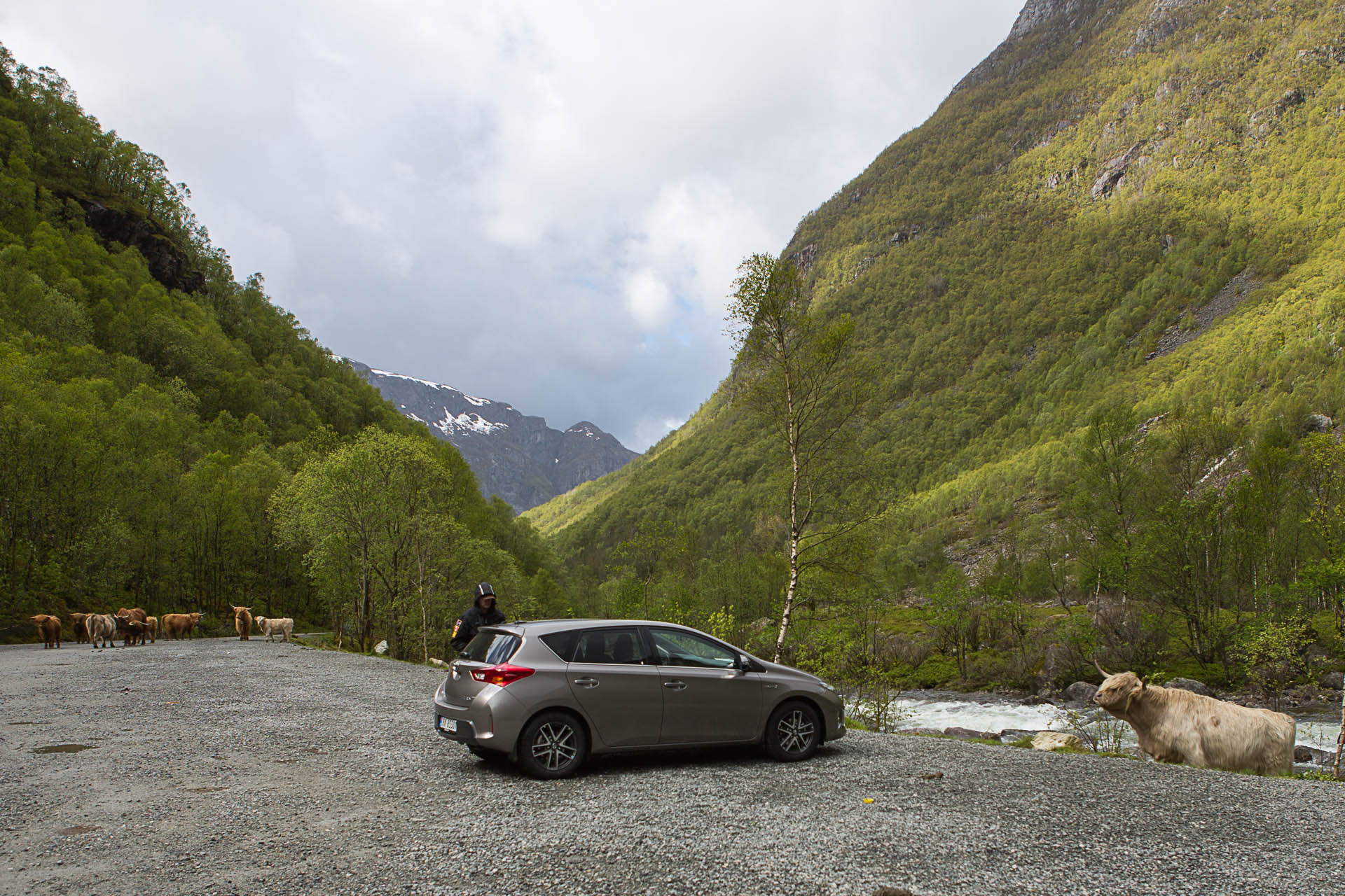 We ended up with a Toyota Auris Hybrid (similar to a Prius in size). The car was small, very comfortable, and made driving the narrow winding roads very easy. The hybrid powertrain also delivered fantastic fuel mileage. Overall, we achieved close to 5 litres per 100 km (nearly 55 mpg) fuel economy on the trip. Great gas mileage was important, as Norway is the most expensive place in the world to buy gasoline (upwards of $2.50 per litre). Perhaps this is why electric vehicles are so popular in Norway. In fact, the completely electric Tesla Model S luxury car is the #1 selling vehicle in Norway. Electric vehicles in Norway are exempt from tolls, ferry charges, and parking fees – attractive indeed. Did the Auris Hybrid have any drawbacks? Yes, it was small and we had trouble fitting our luggage in the car, especially Ryan’s giant suitcase. The car was also low on power which wasn’t a big deal as the speed limit was typically between 50 and 70 km/hour on most back roads.
Scottish Highlands 2016
We spent considerable time deciding what we needed for transportation during our upcoming trip to the Scottish Highlands this spring. There will be four of us on this adventure so we will need more space. However, similar to Norway the roads will be narrow, so we don’t want something too large. We thought we might end up with a midsize sedan like a Vauxhall Insignia, or the very popular Skoda Octavia Estate (wagons are very popular throughout Europe). We considered even larger vehicles, something comparable to a minivan – like the Citroen C4 Picasso. All the cars I just mentioned are not available in North America (some of the options have interesting names though).
 Our biggest issue during the planning stage was finding accommodations on the Isle of Skye. There are not many places to stay and we soon discovered that most were already fully booked for the summer months. The second issue was trying to decide where to stay and when, as we will be travelling all over Scotland on the trip. We want to minimize any unnecessary driving related to the weather. Scotland is known for wet weather and we have planned several major hiking days that will be best enjoyed in good weather. On past trips, we have simply worked with the weather we have. In contrast, on this trip we plan to adjust the itinerary and locations for each day based on that day’s weather forecast. This means that we don’t know where we need to be on a given day. A few weeks ago, Ryan called very excited with a fantastic idea; he had realized that we should rent an RV and just live in it during the trip. That way, we can just stay where we happen to be based on the changing itinerary. It was a brilliant idea. We are now renting a big RV (28 feet long and 10 feet high) – this in itself should provide numerous interesting and entertaining experiences. Imagine four guys living in an RV and driving around the Scottish Highlands and Ryan won’t have to ever worry about finding a bathroom on the trip.
Regardless of the vehicle selected, the most interesting attribute of the vehicle will be that the steering wheel is on the wrong side of the car and that we have to drive on the wrong side of the road. Furthermore, this means that roundabouts will be navigated clockwise, opposite to what we are accustomed to here in North America; because of this, I am sure we will have some entertaining stories to tell from the trip.
Future Trekkit Adventure
 When we are traveling, we occasionally talk about where we would like to go in the future. I have been pushing the idea of an entirely new adventure for the Trekkit Team. An adventure that would definitely push the boundaries of what we have ever done before. This would be an adventure so big and ambitious that it might take us several years to plan and prepare for the trip. I would like to drive motorcycles from Atlantic Canada to the southern tip of Argentina (off-road where possible). Yes, that is correct – the southern tip of South America. Now I realize that this would be a major undertaking and most of us do not even have a motorcycle license at this point. That is why I am proposing a shorter trip to start with, perhaps a trip across the Trans-America Trail (the “TAT”). The Trans-America Trail starts in Southwestern North Carolina, and ends at the Pacific Ocean in southwestern Oregon – nearly 8,000 km of mostly off-pavement riding. The route consists primarily of dirt roads, gravel roads, jeep roads, forest roads and farm roads. Occasionally, you end up traveling through dried-up creek beds and riding atop abandoned railroad grades. The trip typically takes 3 weeks to travel from coast to coast. Based on the amount of off-road riding, the obvious choice would be a dual sport motorcycle. It would be an amazing trip! Stay tuned to see if I can eventually convince Ryan to tackle this adventure.
To keep up to date on all the Trekkit adventures please signup to our Newsletter and catch us anytime on Trekkit TV.
Happy adventures,


 Me (
Me (


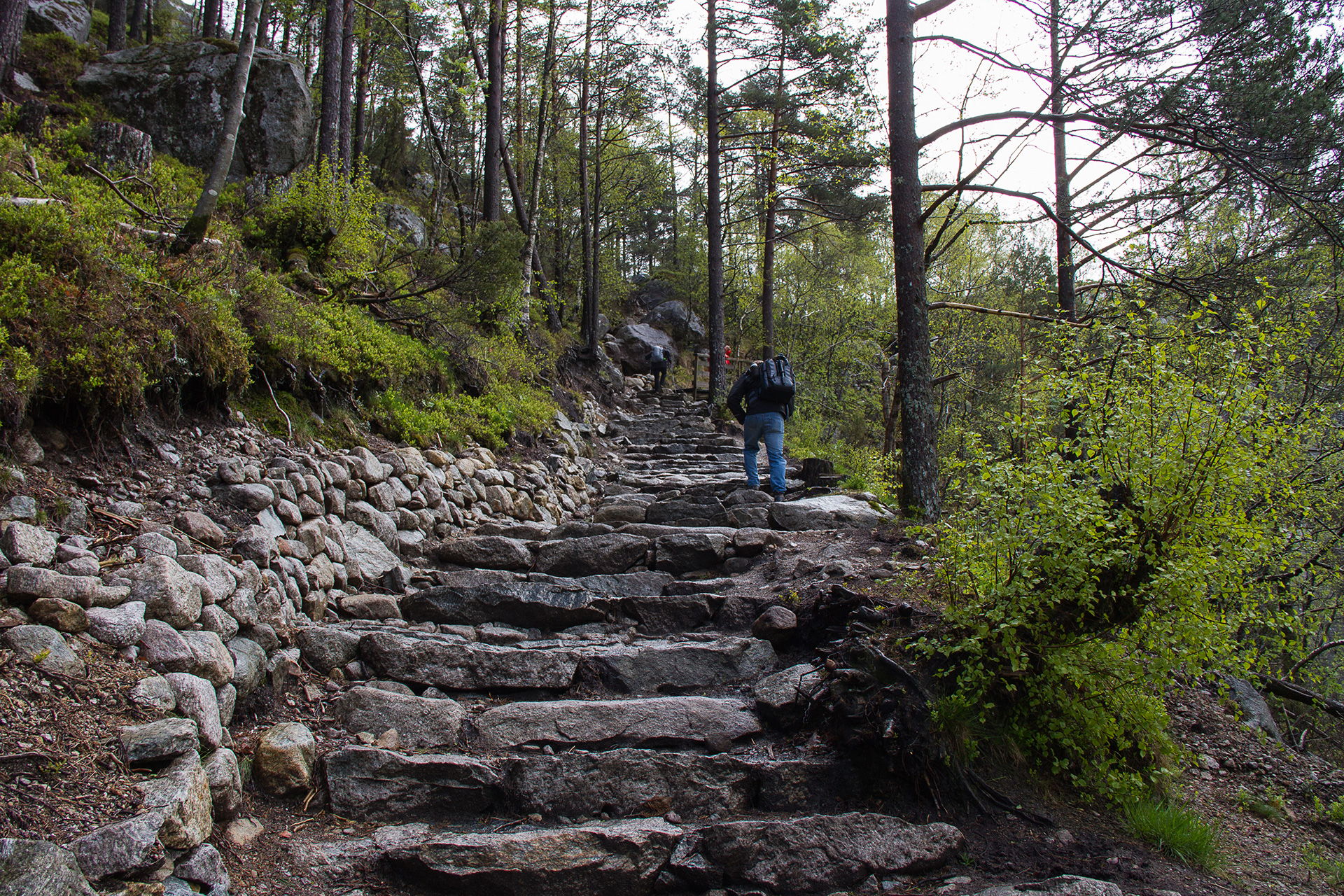


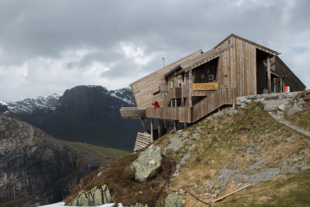
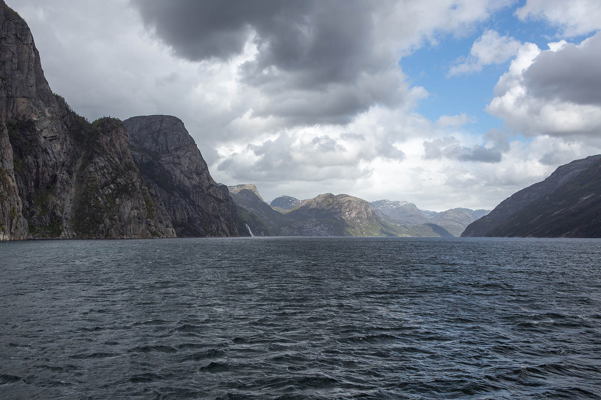
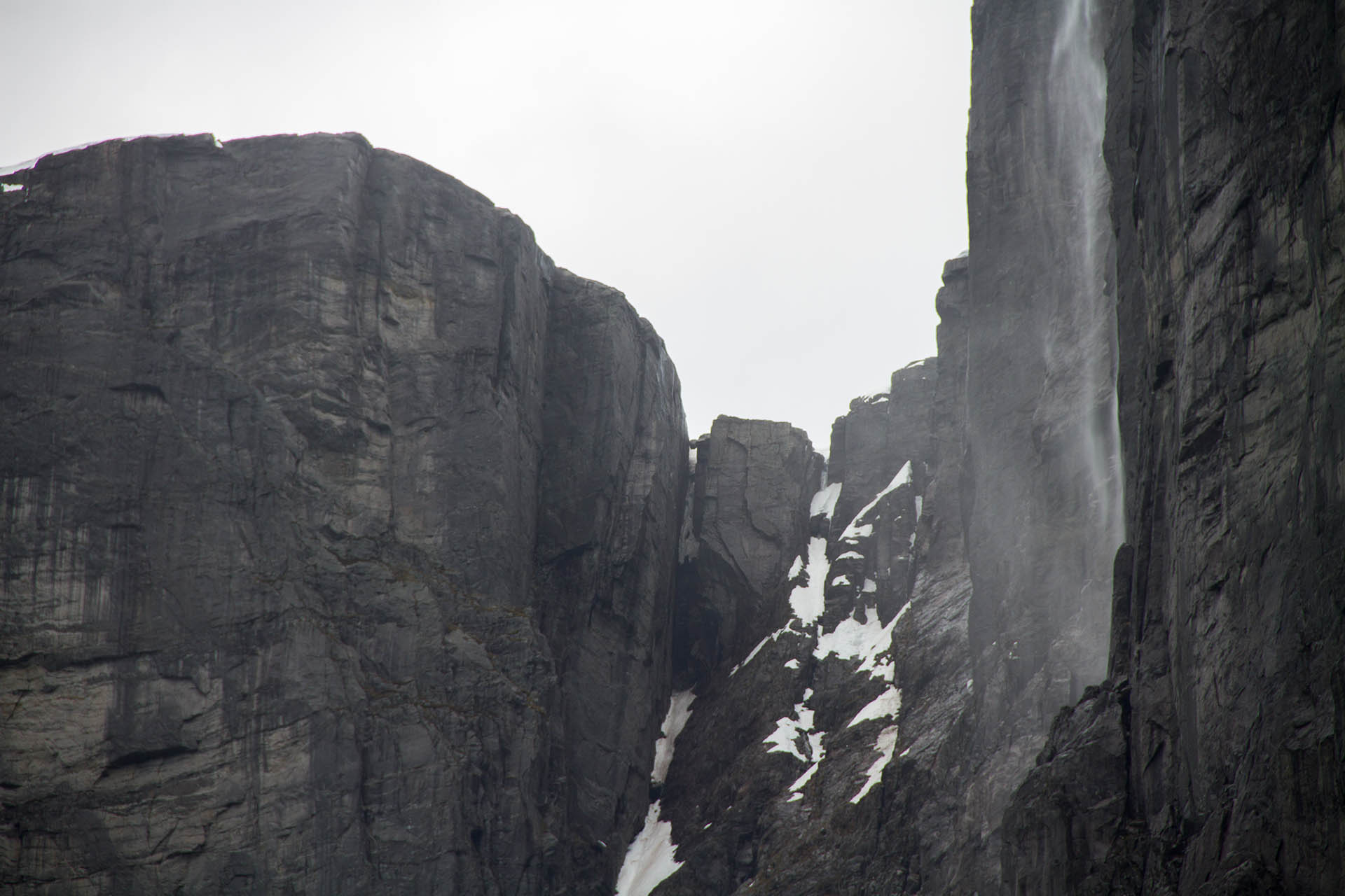
 Øygardsstølen is also the starting point for the hike to the Kjerag Plateau and Kjeragbolten. Once we arrived at the top of the fjord we could appreciate why the path to the Kjerag Plateau was still closed. Wow, there was still a lot of snow on the ground for June! We were told that the snow along the hiking route could still be up to 3 m deep. Perhaps this hike will be a priority on a future trip to Norway. It takes approximately 5-6 hours to make the hike to the plateau, and the trek is described as “strenuous”. However, I think it would be worth it!
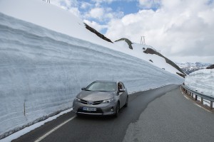 While driving through the “snow road” your ability to see oncoming vehicles is significantly reduced due to the very high vertical snow banks. Of course, this becomes a larger concern when the two-way road is effectively only one-lane wide. We did encounter a semi-trailer truck on a turn requiring both of us to brake quickly! We then had to back up nearly 100 m to a widened area to allow the truck to pass. Fortunately, this was all captured by the “GoPro look-alike” camera mounted on the hood of our car.
 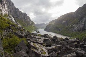 The Gloppedalsura Scree is a large expanse of avalanche boulders that are piled on top of an end moraine created during the last glaciation period. The avalanche boulders cover an area approximately 0.5 km x 1 km and the deposit is up to 100 m thick in the deepest part of the valley. Some of the boulders are as big as houses! It is interesting how the road was constructed through the boulder field. It must have been quite an event when all the boulders fell suddenly into the valley!
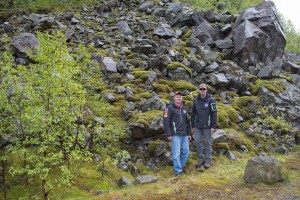 It was here that we discovered that the aerial drone had been damaged during the Oslo to Stavanger flight (Ryan was forced to check the drone with Norwegian Airlines). It appeared that someone had tried to remove the GoPro camera forcibly from the underside of the drone – severely bending the mounting brackets. It was a stressful situation as we rely on the aerial drone to get some of our most spectacular video footage. However, after careful evaluation, we were able to cautiously bend the brackets back into alignment so that the three-axis gimbal could function properly. Fortunately, the drone was once again operational to get the amazing videos that can only be obtained from an aerial perspective.
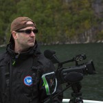
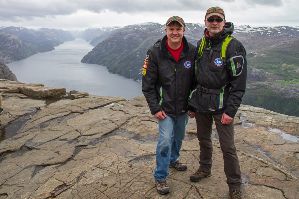
 This ensures that when you are hiking or climbing mountains that you are not the slowest person – giving you a real ego boost; similar to the feeling of being picked first on the school playground for soccer. If you are too slow, your hiking group may slip away from you and then later while they are still waiting for you at the summit they aren’t even sure whether you are even still coming or not. Being in better shape also allows you to film those in your group who are struggling to catch their breath while climbing that hill. Everyone likes to see other people struggling. Being last up the hill is also analogous to being the last to arrive to a house party that has been in full swing for several hours (people are laughing, relaxed, and some are even getting ready to leave). Being out of shape also means that you are likely very sore the next day. It is not fun when you can’t climb the stairs or even comfortable sit on the toilet. Being the fittest is also very beneficial if you are attacked by wild animals as you can easily outrun your travel companion to leave them to deal with the angry bear.
 This can be viewed several ways. You should dress better considering the activity you are doing. For instance, blue jeans are not really appropriate for climbing a mountain. They tend to get heavy in wet conditions and may even show your plumber’s crack at times (remember, we are always filming). You need to wear pants that stretch, breath, and dry quickly. You should dress better for the weather. If it might be very cold on top of the mountain, bring warm clothes with you like a toque and gloves – even if it is a warm summer day when you start the hike. Don’t be the one freezing as you approach the summit that forces the climbing party to turn around. Overall, try to be the best dressed from the perspective of style – in particular as we film these trips. No one wants to be seen on TV looking like your wardrobe is still from the 90’s. Always remember that if you yourself have no idea about dressing fashionably, then you better consult with your wife before heading out on the next adventure.
 On a recent trip, one of our travel companions had a special dietary requirement that should have been disclosed at the start of the trip. The issue was potentially quite serious and based on what happened could have resulted in the need for hospitalization or in extreme circumstances – potentially death. Unbeknownst to us, our travel companion required three square meals per day. Furthermore, the meals had to consist of meat and potatoes served warm in an upper class restaurant. Snack foods obtained at local gas stations or pre-packaged foods such as energy bars could not be substituted in any circumstance. In addition, it must be stressed that any deviation from the typical morning, noon, and early evening feeding schedule was also a serious problem. Now I should be clear that the reference to hospitalization or potential death was not necessarily a direct result of the individual not receiving the proper diet, but instead could have been an indirect result of what could have happened to anyone in our group due to the amount of complaining that occurred. The best example that comes to mind was when we were 100’s of kilometers from any form of civilization when the individual declared that we must stop immediately and have dinner. Now I don’t know what he saw, because the only food for 100’s of kilometers was in our backpacks. So you can see how important it is to know in advance about any special dietary restrictions.
 Like most trips, it starts with the flight on the plane. Flying itself is not particularly fun. You are in a crowded space, you can’t easily move around, and overall I find it exhausting (perhaps in part because I cannot sleep on a plane). Ryan on the other hand just takes a pill and sleeps during the entire flight. As good as this sounds it wouldn’t work for me. I would only be groggy and thick-headed, but still not sleeping. Then, you will spend plenty of time packed in a vehicle not only with your friends but with the entire luggage (remember that Ryan has a giant suitcase) and camera/video equipment. Even though you may be doing lots of hiking or outdoor adventures on the trip, there will still be an abundant amount of time spent driving. While in Norway we travelled 2100 km by car, the distance travelled in Iceland was similar. The final part of the trip for getting close and personal with your traveling companions is of course the nightly accommodations. In Iceland, I spent nights in a tiny room with Paul. He snores! In Norway, Ryan and I spent one night in a hostel where the room was so tiny that only one of us could move around at a time inside the room. I had to wait in the hallway while Ryan was rummaging through his giant suitcase. So make sure that you get along with your traveling companions before venturing out on the next adventure.
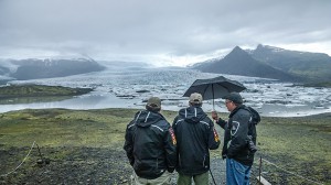 Let’s face it, you cannot control the weather. No matter how much you want good weather, it isn’t something we have any control over. Furthermore, it really seems like the weather forecast isn’t particularly reliable – at least beyond 24 hours. In Iceland, we had several days of rain and wind which makes it very difficult to film and especially difficult to film with the aerial drone. When the weather turned bad, Ryan started to lose his mind. Much of this fear related to potentially returning home with insufficient video for the number of episodes needed (he said his wife would kill him). It took much effort to cheer him up and make the best of the situation. When we were in Norway, bad weather was also frequent. Once again, Ryan had trouble dealing with the situation. I convinced him that we could still film – it just had to be done differently (using umbrellas, shooting from within the car out an open window, etc.). On both trips, Ryan was fixated on continuously checking the weather forecast. He would check it every 30 minutes (like it is going to change that often) and he talked about making drastic changes to our travel plans based on an unreliable forecast at best. As we prepare to visit the Highlands of Scotland, notorious for rain, drizzle, and fog, we have discussed how we will handle the weather. Ryan has assured me that he will be better and that we will simply “roll with it”. Remember, you shouldn’t worry about things that you have no control over.
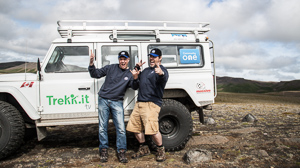 Those who know Ryan and I would probably say we are quite different, perhaps even opposites. First off, Ryan works with computers and technology and I work in the field of engineering and geology. Additionally, some people may say I am meticulous, the opposite of a risk taker, and fussy (I think I may even have heard the words “anal retentive” used to describe me). Others may have used the words: all over the place, erratic, maybe even disorganized to describe Ryan at times. Even though these differences may be insurmountable for a marriage they seem to work well if you are friends traveling on adventures. Where I like to have things planned, being so well organized does not always add to an adventure. This is where Ryan excels – walking more on the “wild side” often brings excitement and great stories to the trip. That being said, my meticulous organization often helps Ryan to stay on task and move from location to location getting great content for Trekkit TV. Let’s just say yes, Ryan and I may be very different in some ways but we do have a very similar outlook on life in general. We definitely want to be outside, breathing the fresh air and pushing ourselves to go beyond our comfort zone. We both believe that people are over stressed and detached from nature. We definitely love to travel and see new things, finding those treks off the beaten path. We both enjoy meeting new people and hearing their stories. This combination of similarities and differences allows us to work great together as a team filming countless adventures for Trekkit TV.
 As I have mentioned before, while traveling you often have long periods of time to kill while on a plane or in a vehicle. The radio is usually not an option as you have no idea what channel is good to listen to, or more likely which channel you and your traveling companion will agree on listening to. This is definitely the case for Ryan and I, as after connecting my iPod to the car’s sound system in Norway, Ryan immediately asked me to turn off that “crazy music”. Therefore, it often comes down to conversation. Now here is where our different talents have often filled in what could have been awkward silence. Since Ryan is the
  OK, this statement is good in a general sense but especially good if you travel to amazing locations every year with the guys. Leaving you wife at home to ferry the kids to their many activities and look after the home while you explore exotic locations around the globe with your buddies does not tend to go unnoticed. During the planning stages of each trip, as much as you want to discuss all the awesome places you will be visiting with your wife, it is best to downplay what a terrific time you will be having while she is still at home. Similarly, upon returning from these adventures, your wife will want to hear all your tales, but remember that she wasn’t there and that she was stuck at home doing the same old routine. Luckily, Ryan and I both have really awesome wives that encourage us to go on these great adventures. Having an understanding wife can make a significant difference.
 In all fairness, I picked out around 30 photographs that I thought were really good. So now we are talking about a success rate of one “really good” picture for every 200 photographs taken. So what went wrong? We had the proper gear and we had practiced and studied how to use the cameras to get great pictures. I believe that the problem was that we were taking pictures like a tourist. When we arrived at the stunning sites in Iceland we piled out of the Land Rover and started taking pictures with reckless abandonment.
  These short comings are by no means a complete list. We didn’t even look at the photographs we took until we returned home after the trip. Don’t get me wrong, we aren’t professional photographers and we did get some really good pictures. We are
 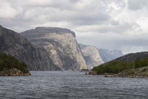 If you simply want to capture the moment, then any old camera will do (even a tablet). However, if your goal is to get a great picture then you need more than just the right equipment. You need to think about the picture you are trying to capture. You need to try different things and you must consider lighting, foreground, background, focal point, etc. Most importantly, you need to slow down and think about the photograph before you even take a picture.
 On our recent trip to
 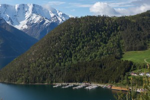 Overall, the lesson learned is that anyone can take really good pictures and if you keep trying you may even get a great picture. However, you have to slow down and think about the photograph. If you simply run around snapping pictures with reckless abandonment (like a tourist), you likely won’t get any pictures worth framing and displaying on your wall.
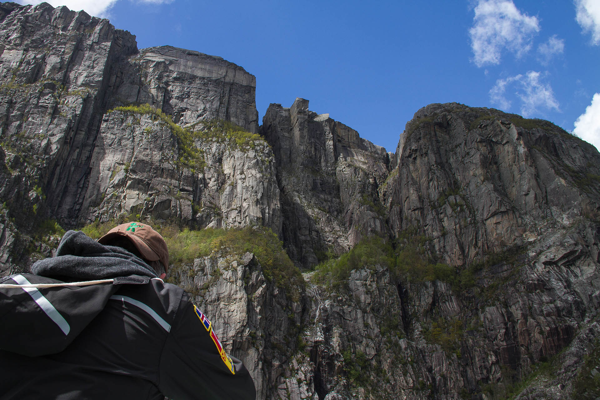


Recent Comments